Posted by @nbaghmz
16 Sep, 2025
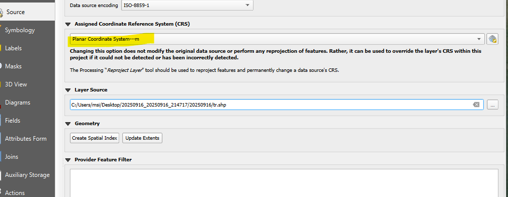
Wrong projection is added to shapefile
Hi,
I created a new project and entered projection to WGS82UTM38, however when I export as gis file, the project of the file is wrongly entered. it should be WGS82UTM38, but it shows Planar Coordinate System---m , therefore the data is not displayed at the correct location, I must manually set the projection to WGS82UTM38.
I checked the .prj file with shapefile, it is
PROJCS["Planar Coordinate System---m",GEOGCS["User Define",DATUM["User Define",SPHEROID["",6378137.0,298.2572236]],PRIMEM["Greenwich",0],UNIT["DEGREE",0.0174532925199433]],PROJECTION["Transverse_Mercator"],PARAMETER["false_easting",500000.0],PARAMETER["false_northing",0.0],PARAMETER["central_meridian",45.0],PARAMETER["latitude_of_origin",0.0],PARAMETER["scale_factor",0.9996],UNIT["m",1.0]]
it looks like the proj file is not correctly set, based on esri prj specification it must looks like this:
PROJCS["WGS_1984_UTM_Zone_38N",
GEOGCS["GCS_WGS_1984",
DATUM["D_WGS_1984",
SPHEROID["WGS_1984",6378137.0,298.257223563]],
PRIMEM["Greenwich",0.0],
UNIT["Degree",0.0174532925199433]],
PROJECTION["Transverse_Mercator"],
PARAMETER["False_Easting",500000.0],
PARAMETER["False_Northing",0.0],
PARAMETER["Central_Meridian",45.0],
PARAMETER["Scale_Factor",0.9996],
PARAMETER["Latitude_Of_Origin",0.0],
UNIT["Meter",1.0]]
WGS 84 / UTM zone 38N - EPSG:32638
I hope you fix this, so the data is displayed on the correct location.